-
Wooden Nickels and Patched Trousers
The other morning, my wife woke up early and announced she was going to go for a walk before it got too hot. I bid her farewell and went into the kitchen to do battle with the ants.
There is an ant hill not far from the back door and, for the most part, we co-exist peacefully, but since the advent of hot weather, the ants have been making forays into the flat looking, I suppose, for food, water and cooler temperatures, all of which they have found in the kitchen.
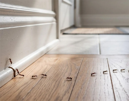
The ants go marching one by one hurrah, hurrah … Now, I’m a humanitarian, and I believe ants have as much right to exist as I do, but not in my kitchen. Therefore, my method of discouraging them is to kill them all and hope the ant commander eventually realises that, if Company A went out and never returned, followed by Company B, C, D and E, they will stop with the suicide squads and go about their antly business elsewhere.
Sadly, that does not appear to be working, so I fear I’ll need to resort to chemical warfare. I don’t want to, but I have no choice; they started it.
But that’s not what I wanted to talk about. I want to talk about what I was musing over as I swooped down upon the unsuspecting ants and chased the survivors around the counter:
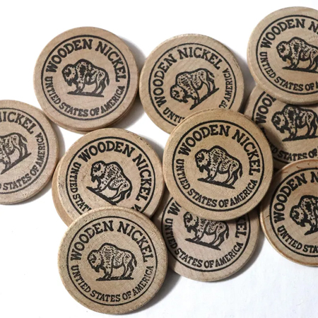
As my wife walked out the door, I said, as is my habit, “Don’t take any wooden nickels.”
No one needs to tell me that’s an old saying. It originated in the late nineteenth century and was undoubtedly used by my grandmother, who passed it to my mother, who passed it to me. This is a saying that is certainly over a century old and, in all likelihood, has long since died out. There is probably no one in America who says, “Don’t take any wooden nickels,” these days. And I’m 100% certain no one in Britain says it because there’s no cultural reference for it.
And that got me thinking of other sayings that have died out, some within the past twenty years. When I first arrived here, “Spend a penny,” was in common use. No one says that anymore. I also heard, back in those days, “Is it big enough to patch a Dutchman’s trousers?” referring to a bit of blue sky spied among rainclouds as a way of predicting the end of the storm, or “Make hay while the sun shines,” which despite its obvious (I hope) meaning has nonetheless gone the way of jump rope rhymes, which is another thing I thought about.
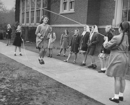
Jump rope, but not as we know it; this is something called “Double-Dutch” which I never heard of until I became an adult but, once I heard about it, my friends and I tried to give it a go and we couldn’t even figure out how to twirl the ropes I admit to having no empirical evidence, but my suspicion is that kids don’t play games like we used to. I haven’t seen anyone skipping rope, with the exception of the young people outside the Boxing Club, but they aren’t reciting any rhymes, and I have not—in the UK or the US—seen a hopscotch grid chalked on the tarmac. Long ago I read an article that spoke of the generational osmosis that kept these games and rhymes going. No one showed us how to play frozen tag, fox and geese, or hide-and-seek. No one taught us “One potato, two potato, …,” “Little Sally Saucer,” “Teddy bear, teddy bear, turn around,” or “George and Mary sitting in a tree, K I S S I N G ….” They were just there, as if they spontaneously appeared when we needed them.
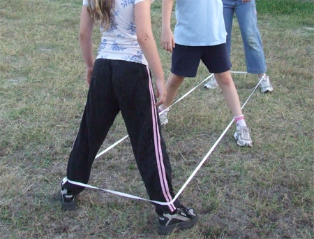
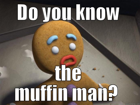
This is Chinese Jump Rope and we had no idea how to play it Likewise, the poems of youth: Jack Horner, the candlestick guy, Bobby Shafto, the Muffin Man, and Mary who, they say, was quite contrary. If it wasn’t for the Shrek movies, all of these would have gone the way of the little black hen who lays eggs for gentlemen. And Shrek alone can’t save all of them.
“Who lives in Drury Lane?” My contact with children is severely curtailed these days (I’d make a joke about a court order here, but you can’t be too careful these days) because I don’t hang around young children (ditto) and my grandchildren and I are in close proximity for about 0.2926% of the time during an average year, but I see no evidence of this osmosis osmosing into my grandchildren, or any children. If that article said these traditions were in danger of dying out, they are now on life-support, with the family hovering around whispering about DNR protocols.
It saddens me to think I’m standing at the edge of a generation watching centuries of tradition and culture being snuffed into oblivion by dancing pixels on a 5 by 8-inch screen.
But there’s not a lot I can do about that. All I can do is discourage the ants from using my kitchen as a bivouac, keep making hay while the sun is shining and, of course, avoid taking any wooden nickels.
BOOKS! BOOKS! BOOKS!
FREE! FREE! FREE!I have a lot of books to shift.
I had them with a local shop that sold self-published books, but the owner is going in a different direction so all the books came back to me and they are taking up valuable space on my desk. Have a look at the sidebar or my book page (don’t forget The Talisman series) and if you see anything you think you might be interested in (or have need of a door stop or a table-leveller), send me an email with your address and I’ll send you a signed copy of the book(s) of your choice.
MFH (at) Lindenwald (dot) Com
I, and my desk, will thank you.
Offer good until surplus books are gone. Not valid with any other offer. Satisfaction with storyline, characterisation, or subject matter not guaranteed. All transactions final. If you take a book, you keep it; no backsies.